Detroit transport map
You can find on this page the Detroit transport map to print and to download in PDF. The Detroit transportation map presents the transports network and transport zones of the transit of Detroit in Michigan - USA.
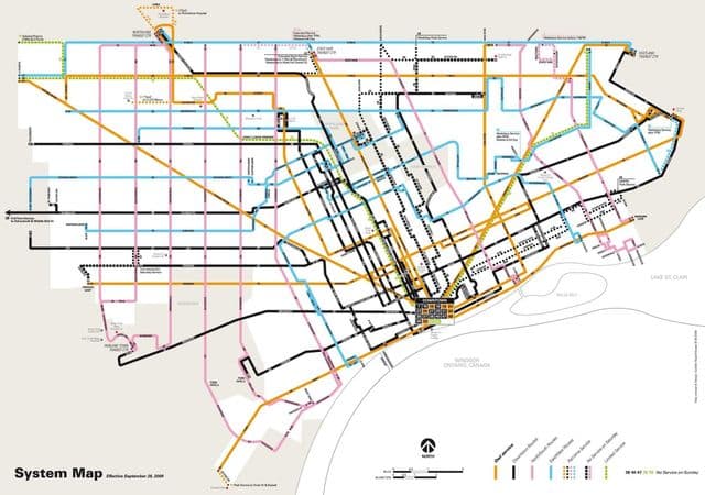
Detroit transports map
The Detroit transport map shows all means of transportation in Detroit. This transports map of Detroit will allow you to move easily with public transport of Detroit in Michigan - USA. The Detroit transportation map is downloadable in PDF, printable and free.
The city has three international border crossings, the Ambassador Bridge, Detroit-Windsor Tunnel and Michigan Central Railway Tunnel, linking Detroit to Windsor, Ontario. The Ambassador Bridge is the single busiest border crossing in North America, carrying 27% of the total trade between the U.S. and Canada. Mass transit in the region is provided by bus services. The Detroit Department of Transportation (DDOT) provides service to the outer edges of the city. From there, the Suburban Mobility Authority for Regional Transportation (SMART) provides service to the suburbs. Cross border service between the downtown areas of Windsor and Detroit is provided by Transit Windsor via the Tunnel Bus as its mentioned in Detroit transports map. It is also possible for those who cross to Detroit on the tunnel bus to use a Transit Windsor transfer for transfers onto Detroit Smart buses, allowing for travel around Metro Detroit from a single fare.